Les systèmes d’alerte…
Par vibrations
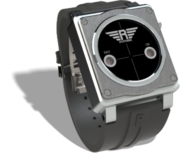
Le bracelet connecté vibre quand une route de collision avec un obstacle est détectée. Il est connecté en bluetooth avec le smartphone ou la tablette du pilote, où se trouvent les fonctions de navigation et de gestion des alertes par l’application R Systems.
Visuels
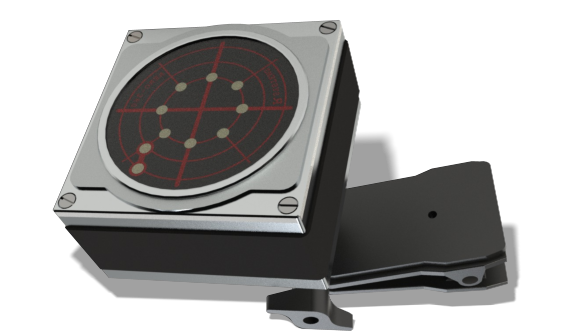
Le LEDAR de visualisation indique au pilote la direction spatiale du danger: Un système de LED disposées en cercle donne l’azimut et l’altitude relative de l’obstacle. Il marche en parallèle et en répétiteur du bracelet.
…Connectés à L’application mobile
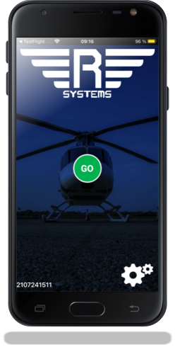
L’application mobile

La technologie brevetée R Systems va au delà des systèmes existants
La technologie R Systems va plus loin que les produits existants à base de moving map. La base de données propriétaire est la première du genre à avoir intégrée les altitudes des obstacles. Grâce à l’analyse de la course (cap, vitesse, position en X, Y, Z) de l’aéronef, R Systems anticipe très précisément les risques de collision.
Par exemple, si une ligne était à 100 pieds au dessus du sol, et qu’un hélicoptère volait à 5000 pieds, le système n’engendrerait pas d’alertes.
A l’inverse, avec le même hélicoptère volant à 75 pieds sol dans la direction de la même ligne, R Systems enverrait une alerte.
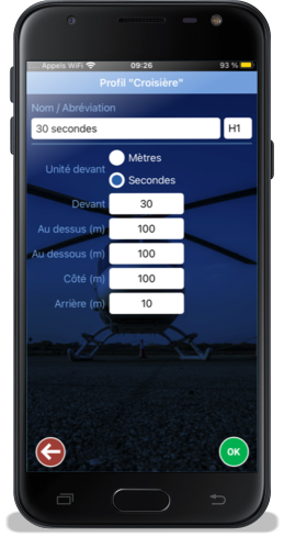
Le pilote peut définir plusieurs profils de sécurité.
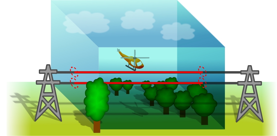
Un profil de sécurité consiste en un volume virtuel dans les 3 dimensions X Y et Z. Quand un obstacle de la base de données intersecte ce volume, le système passe en mode alertes.
Le dessin ci dessous illustre un profil de sécurité, dessiné autour de l’hélicoptère, avec une section de la ligne qui rentre dans le profil : Le segment en rouge.
Grâce à sa technologie propriétaire et sa base de données, R Systems peut déterminer avec précision que cette ligne électrique représente un danger. Elle aurait été au dessus du profil, il n’y aurait pas eu d’alertes de collision.
Disponible


